Landscape architecture’s power to connect people to place is exemplified by two of New York’s iconic landscapes: Central Park and The High Line. A recent study trip to the United States gave four postgraduate landscape architecture students from the University of Western Australia an opportunity to explore these key projects, conceived about 150 years apart.
The pedestrian experience of these two sites has become a qualifier for engagement with the narrative of New York on both local and global scales. The sites assist local communities in constructing the city’s identity and successfully market the experience of place to national and global communities. They construct a narrative that connects people to place through both physical experience and the imaginary, informed by the promotion and veneration of these landscapes.
Each project is an exemplar of a place for pedestrians in which the act of “promenading” extends the edges of site into the broader city. The two north–south streets that run parallel to the edge of Central Park, Central Park West and Fifth Avenue, promote movement through Manhattan before one might slip “off the grid” and in to the park’s nooks and crannies. Although more complex to access – once found – a visitor to The High Line is rewarded with an elevated, complex and multilayered experience of promenading.
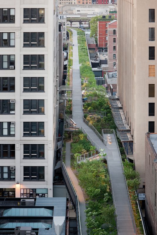
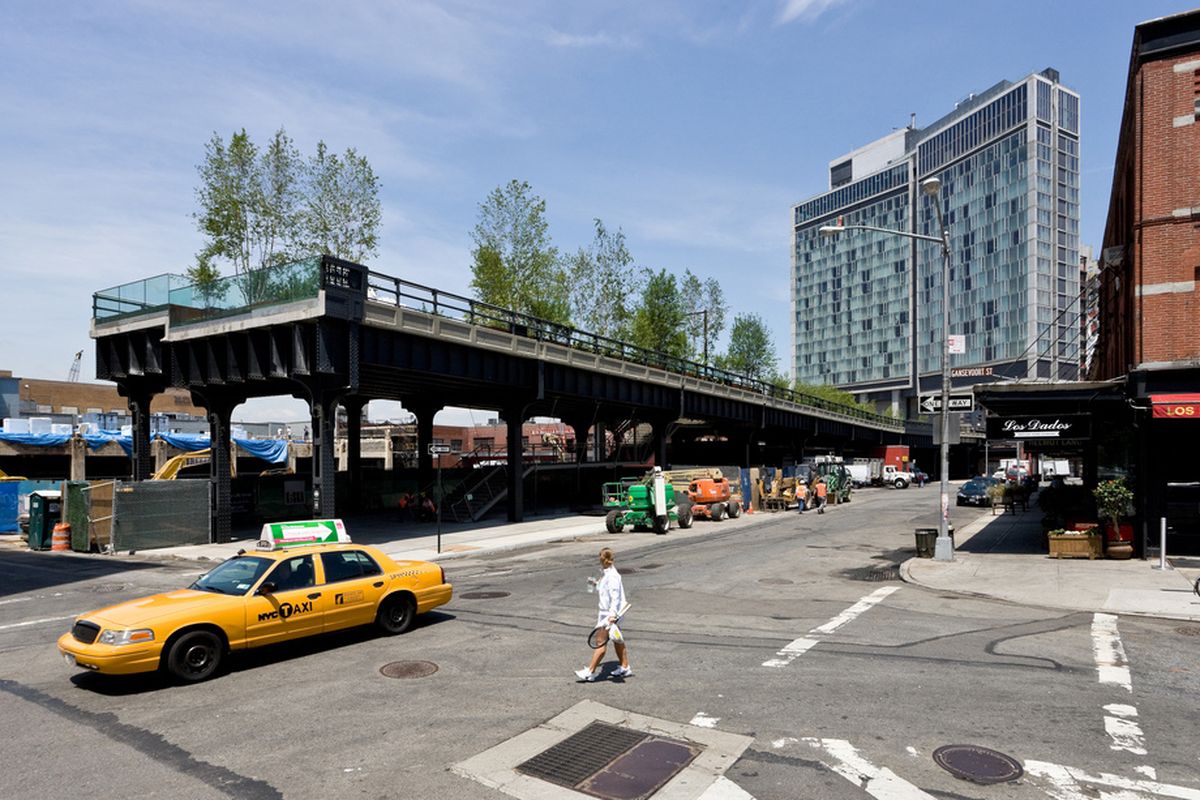
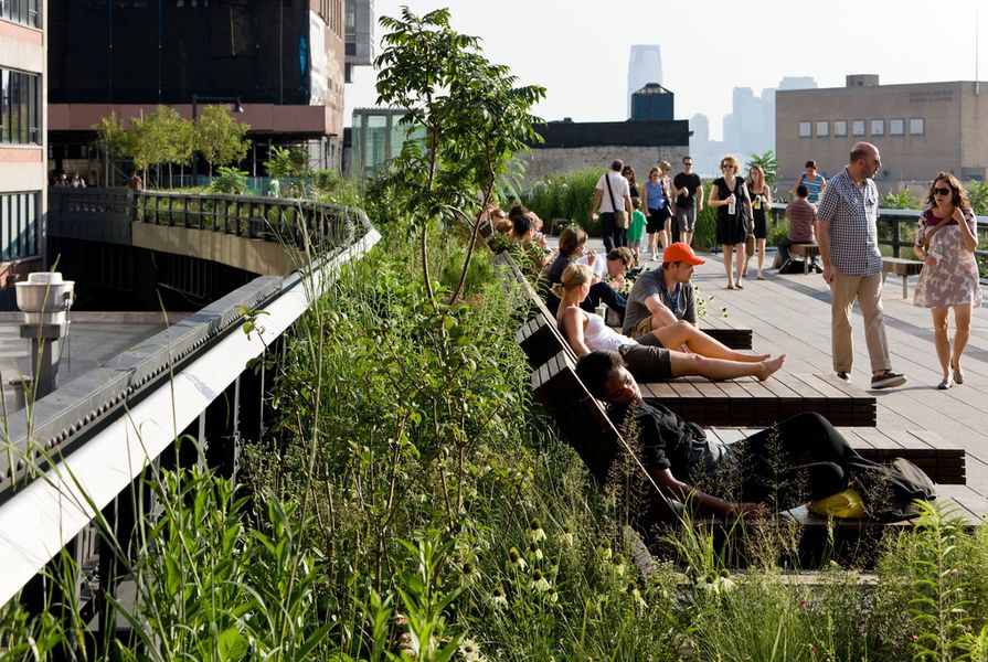
Designed by landscape architect James Corner Field Operations with architects Diller Scofidio + Renfro and planting designer Piet Oudolf , The High Line (2009–2011) is a 1.6-kilometre-long public park built on an elevated and disused 1934 freight rail line in Chelsea, which has been opportunistically and successfully inserted into the dense fabric of contemporary West Side Manhattan. The layered, systems-based insertion is solely for pedestrians.

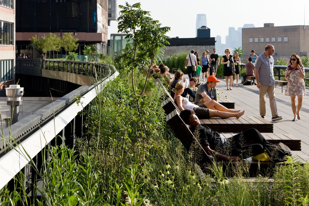
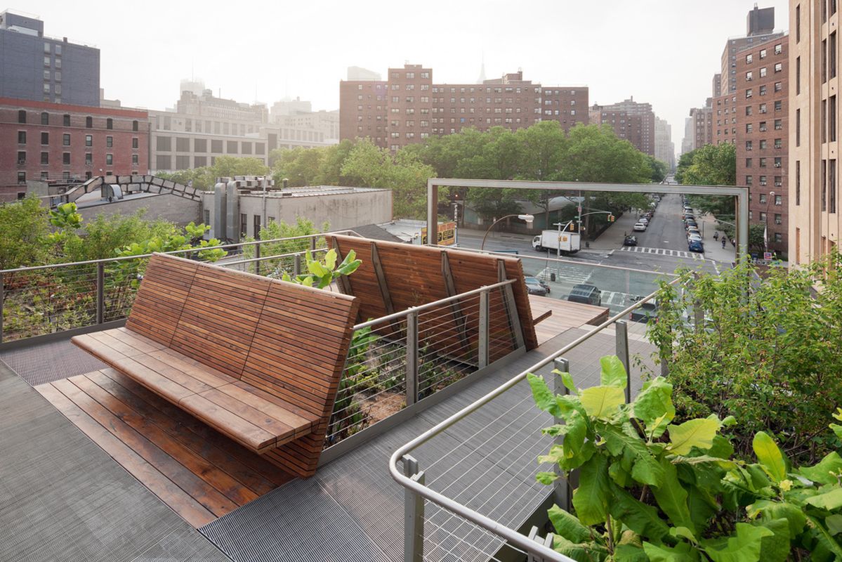
Daybeds in the park offer a rare opportunity for Manhattanites to lounge in the sun.
Image: Iwan Baan
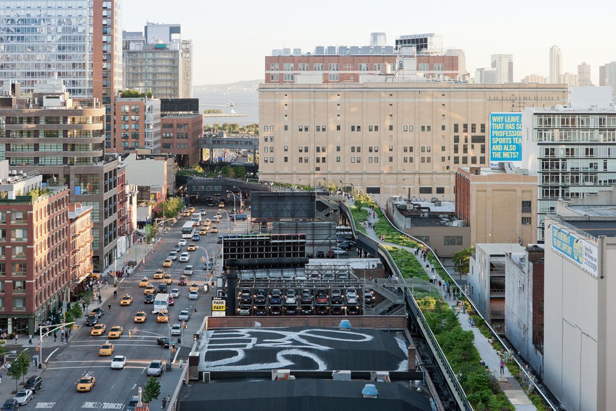
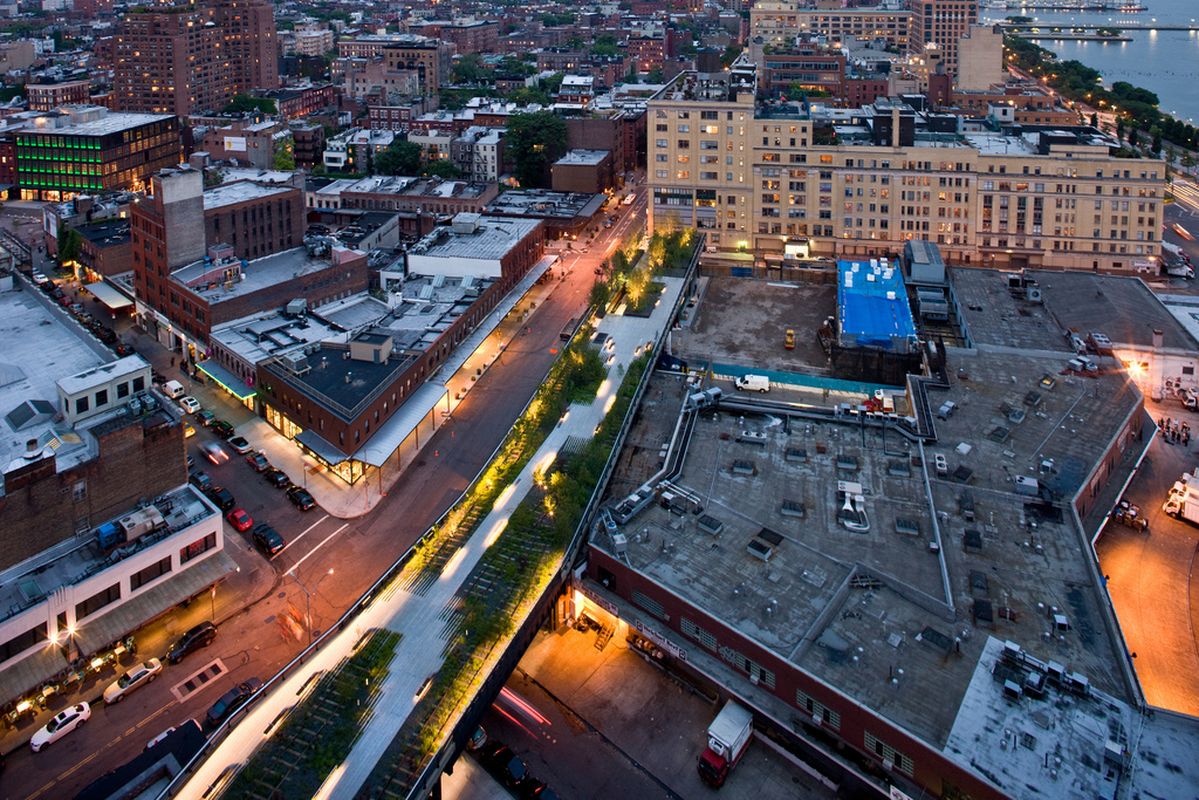
It is a post-industrial “celebrity” landscape that offers back-stage views to the landmarks of Manhattan and beyond over the Hudson River to New Jersey. It also provides clandestine views into apartment windows, service docks and otherwise unseen machinations of the city. Many of the collective nodes along The High Line are visually voyeuristic, as in the instance of the glass-windowed theatre overlooking Tenth Avenue. In contrast, the same landscape provides multiple places for a solitary figure to pause and reflect, even when crowded, and gives a rare and continuous respite from the street traffic below.

Platforms offer voyeuristic views out to the city traffic below
Image: Iwan Baan
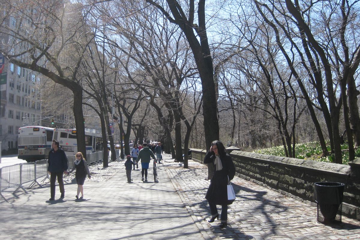
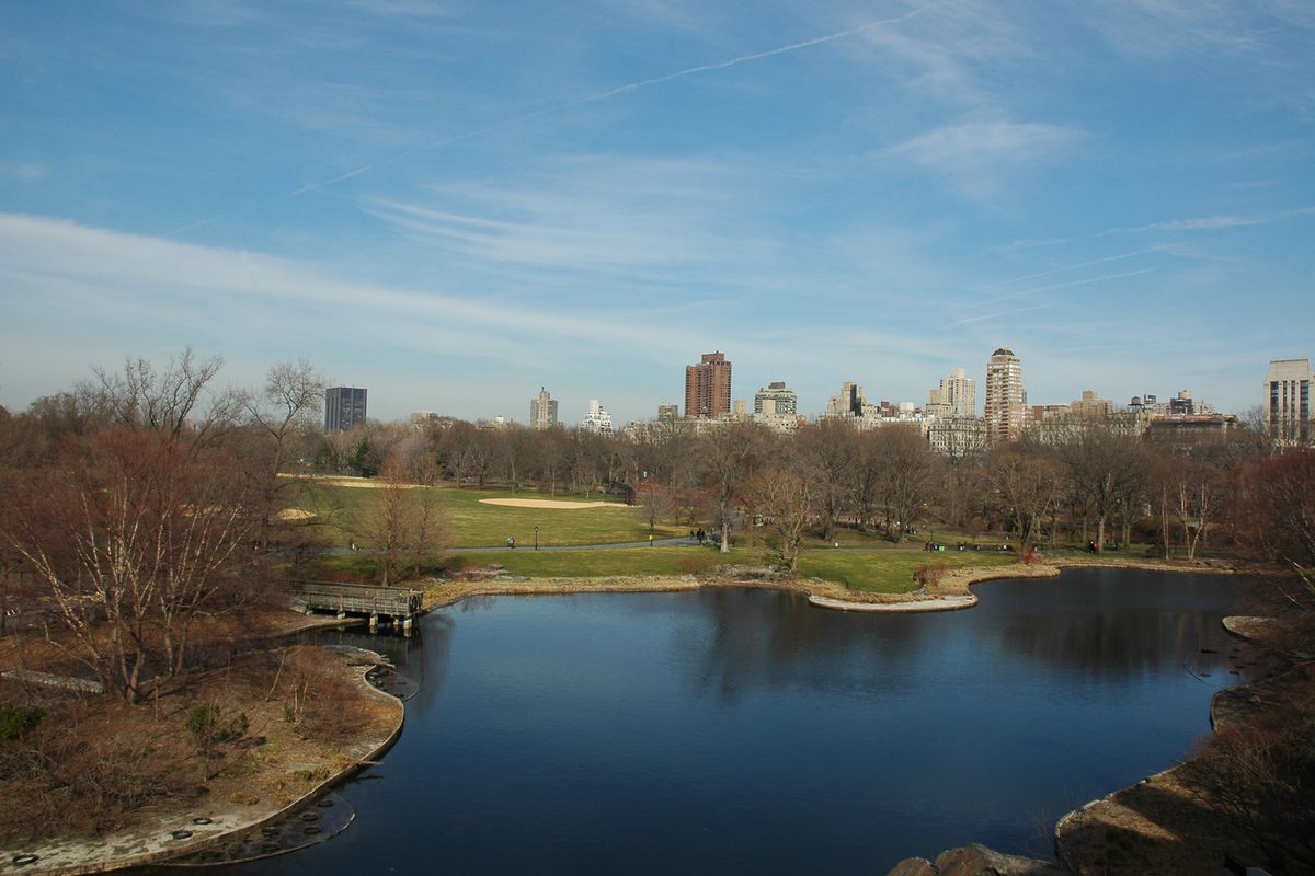
Frederick Law Olmsted and Calvert Vaux’s competition winning grand vision for a 340-hectare Central Park (1858–1873) provided exceptional foresight regarding the future needs of a dense urban population. The Arcadian landscape was designed to improve the lives of urban residents, to rehabilitate the social unrest that resulted for a major wave of immigration to New York City. Similarly, The Higline has accelorated the gentrification of its neighbourhood the Meatpacking District, and more importantly, engaged the disadvantaged residents of the area in a meaningful urban activation.

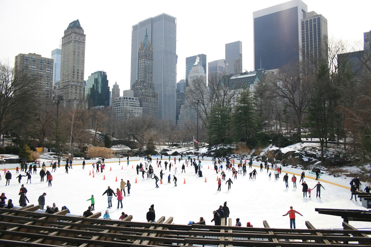
Ice skating in Central Park.
Image: Linda Cheng
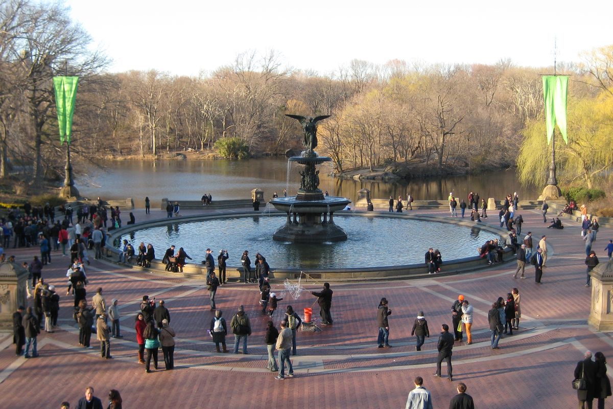
Central Park it has come to embody far more than a pastoral landscape for the lone city dweller. Olmsted and Vaux integrated a complex hierarchy of circulation routes, of which the pedestrian network is just one. Vehicular, bicycle and horse-and-carriage traffic were also sufficiently catered for and continue in the park today. Like The High Line, the park is as much about the collective experience as it is about the absence thereof. The park is punctuated by moments of collective activity; from formal promenading along the Mall walkway to Bethesda Fountain, to relaxing on the Great Lawn tucked in behind The Metropolitan Museum of Art. Baseball, ice rinks and roller discos give way to bird watching, squirrel chasing and solitary reflection offered by the conduit of less-formal spaces. Ever present are the tips of skyscrapers poking through trees, which form a unique and remarkable backdrop.
Central Park and The High Line sit at two ends of a design spectrum in approach, yet they share critical experiences. One is Picturesque, the other Post-Industrial, and each shares nostalgia for nature as a backdrop to interpret, embrace and survive the city. One took 150 years for the trees to mature, the other was inserted as an instant landscape, yet both are recognized as destinations unique and integral to contemporary New York. Most importantly for the role of landscape, the influence these two sites exert on connecting the global community to the city has been phenomenal, raising them to the equivalent of landscape celebrities. These projects demonstrate that the power of landscape to connect is not bound by scale, time or formation. Landscape allows people to connect with the city when it facilitates, strengthens – and in some cases creates – a shared narrative of place.
Robert Hammond, co-founder and former executive director of Friends of the Highline, was in Melbourne in October 2013 speaking on the innovative business model that brought The Highline to life. In a panel discussion chairdd by Rob Gell, Hammond answers the question, are there lessons from The Highline for Melbourne?
Source
Discussion
Published online: 20 Mar 2014
Words:
Simon Kilbane,
Josephine Neldner,
Sara Padgett Kjaersgaard,
Gerard Siero
Images:
Iwan Baan,
Josephine Neldner,
Linda Cheng,
Padgett Kjqersgaard,
Simon Kilbane
Issue
Landscape Architecture Australia, August 2013