The automobile, more than any other invention, had the greatest effect on human life in the twentieth century. In 1927 there was one car for every sixteen inhabitants in Australia, ranked fourth behind America, New Zealand and Canada, but far ahead of the next highest country, Argentina, with a ratio of 1:43. Unlike Europe, these societies shared combined conditions that suited the initial, rapid uptake of the automobile – high per capita income and equitable income distribution, relatively low population densities spread across vast rural distances and a penchant for cheaper, sturdier American cars. The ride continued without repercussions until the 1960s, when decade-old air pollution recognition began to receive legislative attention in attempts to reduce hydrocarbon and carbon monoxide emissions.
Concurrent with global concern regarding the deleterious effects on the health of societies, negative aesthetic consequences of the automobile for Australia’s built environments were being polemically extolled by Robin Boyd and Donald Gazzard. The ramifications of unfettered automobile use became a design conundrum – how to serve immediate and popular individual benefits granted by the automobile while bestowing equal, longer-term community benefits.
However, it was in Europe that the inequality in design considerations, which had previously favoured the flow of traffic over pedestrian movement within towns and cities, first began to be turned around. Manifested from British and Dutch research in the 1960s focusing on developing environmental capacities for roads based on quantified measures such as noise, pollution, social activity and visual aesthetics, was the concept of a woonerf (literally translated from the Dutch as “residential ground”), which, as its precursor, also became synonymous with the concept of shared space. Central to the desired purpose of shared space was an awareness of the need to redesign residential roads to favour pedestrians instead of the consistent kowtowing of urban planning and design to facilitate car travel.
In 1976, the Dutch became the first of several mainly European countries to legally endorse the principles of shared space. Characterized by an informal and deregulated sharing of public space, the shared space street becomes a zone of integration, a non-exclusionary plaza still open to automobiles but where pedestrians are afforded priority instead.

John Mongard Landscape Architects’ shared space project on the main street of Gladstone in Queensland is a ten-kilometre shared zone.
In order to successfully achieve the goal of pedestrian reclaimed streets, several design principles characterize shared space developments. Limiting vehicle speeds to around fifteen-to-twenty kilometres per hour allows drivers to establish eye contact with pedestrians and cyclists as well as experience life on the street differently from the automated responses dictated by road signs and traffic lights. Through traffic is discouraged or excluded to help facilitate this objective. In addition, removal of road signage including centre lines and traffic lights creates an ambiguity that has been shown to increase drivers’ awareness of the surrounding environment, as uncertainty stimulates a cautious approach including reducing vehicle speed.
Shared space design recognizes a behavioural distinction in automobile drivers between the slow pace and irrational use of public space and the fast and predictable use of highway space. Transitional areas between the two are minimized to avoid confusion. Road texture treatments, both visual and haptic, kerb removal for seamless footpath and road integration, and narrowing of road width and alignment changes are all important psychological indicators used in conferring these transitions to reduce car speeds entering shared spaces to pedestrian and cycling paces.
These design principles of woonerf have been extended from their use in residential areas and applied to town centres, where they are used to tackle vehicle congestion, road safety and to promote social and economic vitality. Initial European examples were in the towns of Drachten, Netherlands (population 45,000) since 2003, and Bohmte, Germany (population 13,000) since 2007, where most traffic lights and stop signs were removed. At the Zentralplatz in Biel, Switzerland, there has been no loss in vehicle travel times and a decrease in serious accidents has occurred as a result. In Australia, a shared space intersection in the town centre of Port Macquarie, on the central New South Wales coast, has been operating with no discernable effects on traffic flow and safety since completion in 1995. Negotiating site context is important in determining the success and efficacy of shared space designs away from exclusively residential streets.

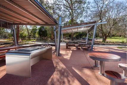
Gamble McKinnon Green’s Ernest Street shared zone runs through the middle of Southbank Institute of Technology.
Image: Scott Burrows
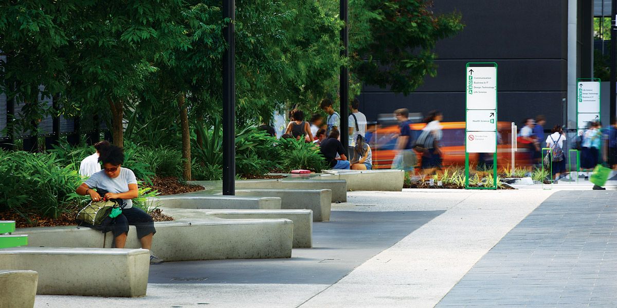
To date, most examples of shared space in Australian cities have been confined to laneways such as Little Malop Street, Geelong; Hardware Lane, Melbourne; and Ernest Street, South Brisbane. This is unsurprising given the relative ease of securing these low-automobile-volume streets, primarily fronted by restaurants or cafes suited to pedestrian orientations. Shared space masterplans encompassing large sections of towns have yet to be realized in Australia, where installing pedestrian networks offers greater challenges across larger, more heavily used streets. The largest scaled shared space proposal in Australia was for the CBD in Bendigo, Victoria, where Hargreaves Mall formed the central area of a proposed shared space masterplan. While it is recognized that improvements in pedestrian spaces enhance economic activity within business areas, many of the recommended initiatives for Bendigo have been delayed or stymied, with little overall work completed. In general, all streetscape design is affected by a multifarious conglomerate of clients, timelines and users that makes outcomes suitable for all parties exceedingly difficult despite open and collaborative design processes taking place. Many interest groups, from emergency services representatives, cycling, local resident and business associations through to Guide Dogs for the Blind, fail to agree on proposals. Visually impaired people have objected to shared space projects both in Australia and overseas on the grounds of safety. In addition, political governance changes so that initial support can tend to sudden prevarication.

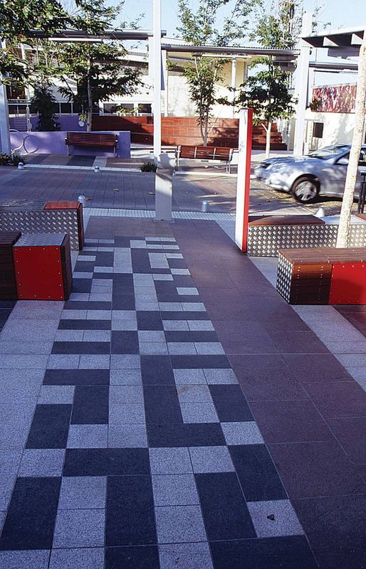
Rush\Wright Associates’ Maddern Square project in Footscray, Victoria includes edge elements to emphasize the area as a shared space rather than separate zones.
Image: Peter Bennetts
Currently in Australia, shared spaces are being incorporated into urban renewal plans such as Aspect Studios’ Oakleigh Village rejuvenation project in Melbourne, Central Dandenong’s City Street project and SJB Urban’s Moore Street shared space project abutting the train station and civic hub in Moe, Victoria. Shared spaces are being seen as a design panacea, a means of integrating infrastructure with landscape while instilling pedestrian amenity and increasing commercial development by incorporating traffic management that neither compromises safety nor affects access to all road users. Although road signage is predominately removed from shared spaces, bollards are still often used where delineation between pedestrians and vehicles really is required. Fixed and operable bollards still act as visual markers determining road use for all users, with operable bollards removed for public events or service vehicles. At Rush\Wright Associates’ Maddern Square in the Melbourne suburb of Footscray, both seating and traffic management functions are incorporated in the design of its bollards.
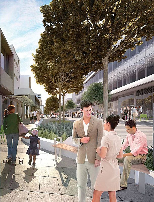
The objectives of shared space design coincide with those espoused in the wake of new urbanism planning theory, which has spawned policies such as Pedestrian Oriented Development (POD), Traditional Neighbourhood Development (TND) and New Pedestrianism (NP). While variations in approach can be divergent, all seek to reduce the reliance on or use of automobiles within local communities. However, a recent concerted road design fad to discourage car use in residential Australian streets fails to advocate the sharing of space at all. Driven by bicycle lobby groups, bicycle lanes in inner suburban areas of Australian cities have enjoyed an accelerated appearance over the last decade. These lanes take space from one major road user, the automobile, and in principle make the cyclists the new exclusive user of that part of the road. For these roads, more rather than less signage and road demarcation is required and the consequence for aesthetic quality around the neighbourhood is obvious.
Throughout the history of the automobile, private car dependence has been much smaller in Europe than in North America and Australia. As an obvious consequence, shared space projects have found greater support and implementation in European countries. As a residential population has returned en masse to town and city centres in Australia over the last decade and empty nesters have begun to roost, browse and sip in inner city suburbs, the need for motorists and pedestrians to find common ground has increased. While a socioeconomic bias exists between less affluent suburbanites and those able to afford inner-city realty served by good public transport and short travel times between home and work, there is still an overwhelming tendency in new outer suburban developments to favour automobile travel over other forms of transport. Yet within these developments lie many opportunities to design and construct shared spaces in appropriate residential areas.
A few years ago, Richard Ingersoll posed the question, “How is it possible that people allowed themselves to live in a world without pedestrian streets?” This question can be initially answered by the appearance of affordable and reliable private automobiles. After centuries of streets being the loom on which the fabric of community life was woven, mass prosperity in the twentieth century fuelled detached dwellings, driving the success of the private automobile. However, the popularity of the automobile in itself does not adequately explain why the street became such a bane for pedestrians. Despite the medley of both real and lame excuses, those charged with designing public landscapes have for too long been asleep at the wheel. The recent awareness and embracing of shared space principles is evidence that landscape design professionals are recovering from their amnesia to put the brakes on the automobile’s free ride at the expense of all other road users.
Removing typical cues encourages a heightened awareness
“Recently the concept of ‘shared space’ has been embraced by urban designers and traffic planners. The concept involves removing the typical cues that exist in urban streets that tell patrons how to behave. The removal of these cues encourages a heightened awareness. The subtleness and everyday nature of pavements, kerbs and line markings give users information about how to behave. By introducing ‘shared space’ we are removing many of these cues and encouraging users to be more aware about their own behaviour and that of others. By removing some traditional cues we are also removing items that people perceive as safety measures. If these features are removed, the logic follows that the space is less safe. However, it is important to note the difference between real safety and perceived safety. CABE research showed that designs that increase the ‘perception’ of risk can reduce ‘actual’ risk by forcing all space users to be more aware and vigilant. Counterintuitive as it is, in shared space fewer ‘safety’ features can equal greater actual safety. Convincing a local community of this is often difficult and community engagement is key. A significant issue in many cases is not technical or budgetary, but about the appreciation of the design philosophy. Once educated and informed about shared space, sceptics can change their views. The use of effective communication, community engagement and constant information provision cannot be understated. In Bendigo, where shared spaces have been operating for a number of years, the community reaction has been mixed. Some community members are critical, accusing the design team of ‘pixieland utopia,’ while others have been very supportive. After a number of years, the Bendigo shared spaces have proven to be flexible and effective. Lessons can and should be learned from the processes that delivered them.”
—Tim Buykx, associate landscape architect, CPG Australia (formerly coordinator of landscape and open planning, City of Greater Bendigo).
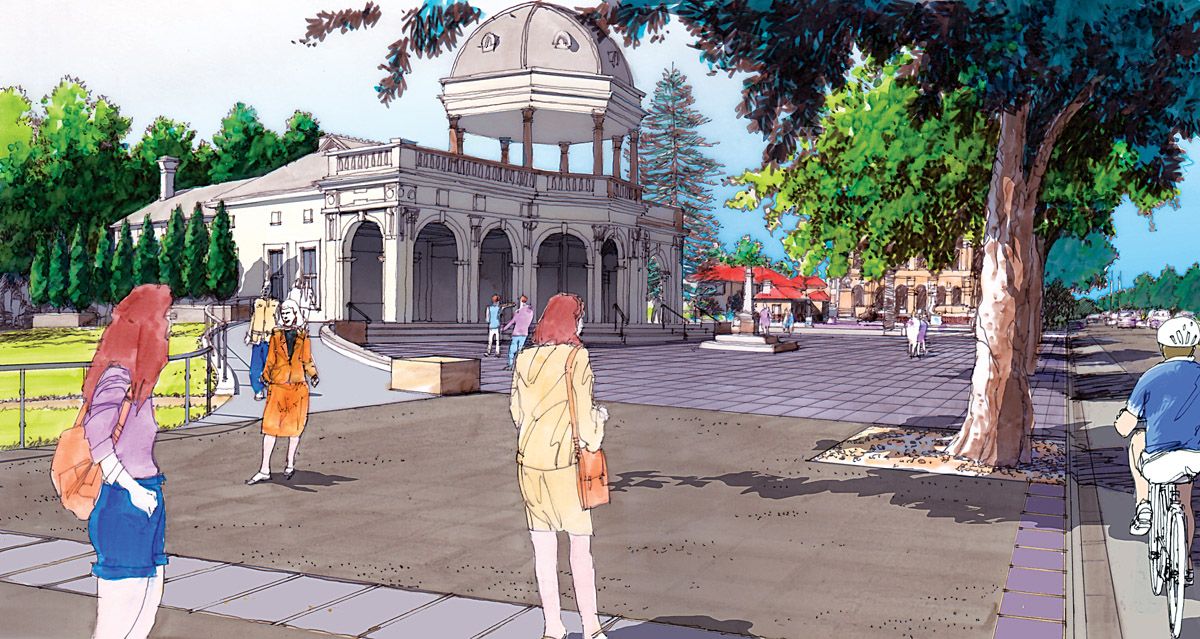
The shared space intersection of Horton and Clarence streets
“In 1995, a design team led by consultants The Geolink Group was engaged by Port Macquarie-Hastings Council to undertake the detailed design of the Port Macquarie Town Centre Master Plan (TCMP), including the shared space intersection of Horton and Clarence streets at Port Macquarie. Since its construction, the intersection has attracted a significant amount of scrutiny and debate. Despite this, the configuration of the intersection remains unchanged from its original conception.

Intersection of Horton and Clarence Streets in Port Macquarie’s CBD.
While no concrete statistical data exists to support an emphatic claim that the intersection is safer than it was prior to 1995, discussions with a number of people who understood the operation of the intersection prior to its reconstruction indicate that there have been less accidents and it is generally safer for users. What is certain is that the new Horton Street intersection actually challenges the way in which motorists and pedestrians perceive traffic and pedestrian function and priority.
Sadly, in an increasingly litigious society, civil laws have recently tended (perhaps unwittingly) to condone diminished personal responsibility, resulting in risk-averse design solutions which employ segregation of user groups and over-regulation as immovable standards. This design solution, and the shared space concept generally, effectively challenge this increasingly evident and disturbing legal (and hence behavioural) trend.
Instead, through the use of an intrinsically low traffic speed environment, the design facilitates and requires a level of intuitive judgment on the part of each individual motorist and pedestrian. It is this behavioural response, from all users, that has resulted in the enhanced performance of the intersection.
What has never been questioned in the case of the Horton Street and Clarence Street intersection, and the constructed Port Macquarie Town Centre Master Plan works generally, is their enormous contribution to the much needed resurgence in both business centre confidence and redevelopment. The town centre is now pleasant and attractive, and boasts a vibrant business sector.”
—David Tooby, director, King and Campbell (formerly director, The Geolink Group)
Source
Discussion
Published online: 27 Sep 2011
Words:
Julian Bull
Images:
Peter Bennetts,
Scott Burrows
Issue
Landscape Architecture Australia, May 2011